Newtown open Thursday to Sunday, 11am to 4pm

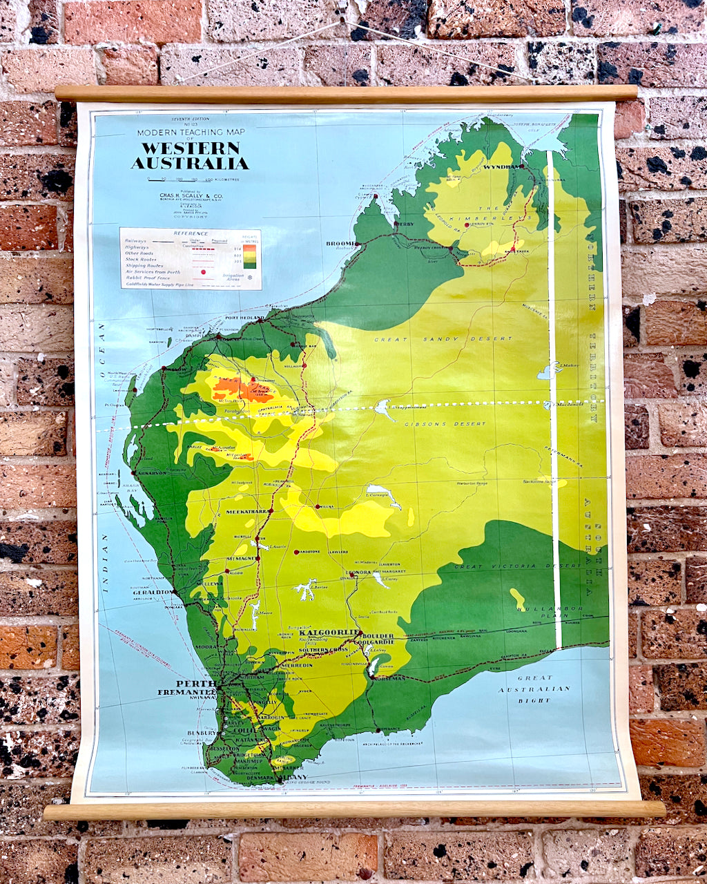
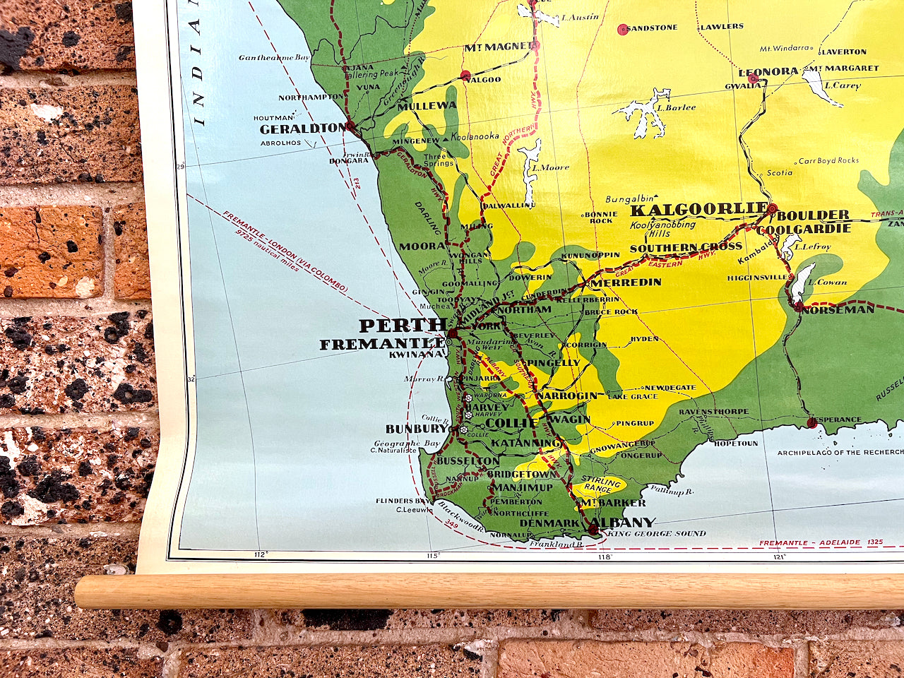
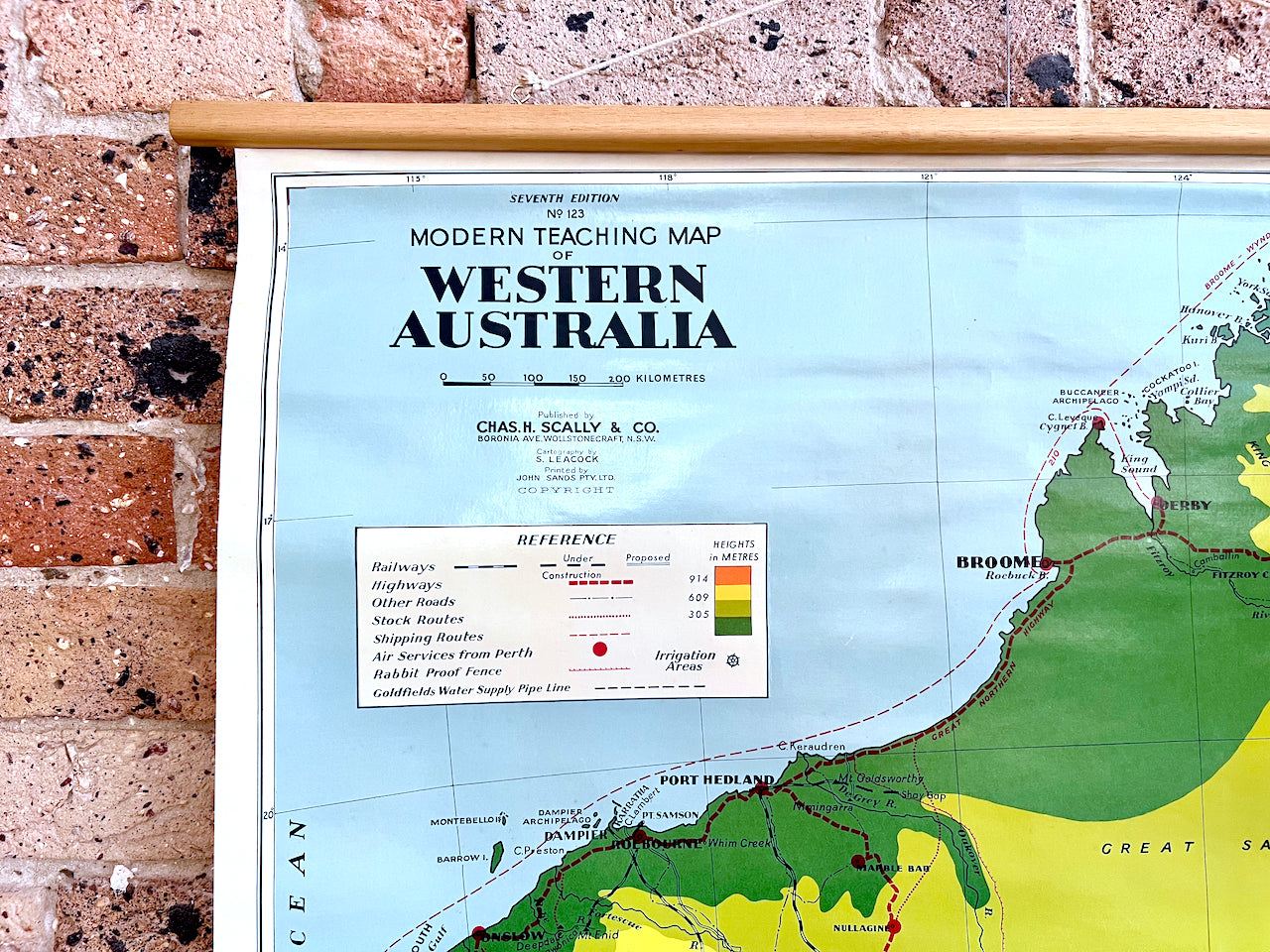
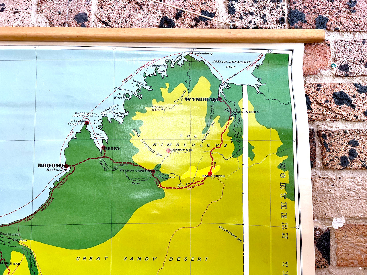
Vintage Educational School Map - Western Australia, Map #123 | Published by Chas. H. Scally & Co, NSW | Circa 1960s

$295.00 AUD
Tax included. Shipping calculated at checkout.

A fabulous addition to any home decor - and perfect to fill that blank space you've been looking at for ages.

We're excited to be able to offer this great pull-down educational school map of Western Australia, Map #123. Published by Chas. H. Scally & Co in Wollstonecraft, NSW. This version was printed in the late 1960s, we're lead to believe.

This beauty is a sight to behold, measuring a nice 1.15m tall and 95cm wide.

It's in great to excellent vintage condition, with only a small amount of wear along the edges as you'd expect and some discolouration. No overall major wear however. We believe the material is a linen canvas base, and it has wooden dowels.

Write a review